A commercial project off Mill Street hit an unexpected paleochannel at 18 feet — the contractor lost two days pumping water and stabilizing the excavation. We got the call on a Thursday and deployed a VES array across the site Friday morning. Reno’s alluvial fans hide buried channels, fracture zones, and perched water that standard drilling often misses. Electrical resistivity surveys map these features before the backhoe arrives, giving the geotechnical engineer a continuous profile of subsurface layering. For sites near the Truckee River corridor where groundwater table fluctuations are a daily reality, we combine vertical electrical soundings with CPT testing to pin down both stratigraphy and pore pressure in a single mobilization.
Resistivity data maps what drilling alone cannot see — paleochannels, perched water, and fracture zones across Reno's complex alluvial fan stratigraphy.
Service characteristics in Reno
Typical technical challenges in Reno
IBC Section 1803 requires subsurface exploration data adequate to characterize site conditions — and in Reno, skipping a resistivity survey before setting boring locations is a gamble. The city straddles the Walker Lane seismic belt, where basin-edge faults and fractured bedrock create pathways for groundwater that can destabilize excavations and foundations. Our field crew has mapped resistivity contrasts across dozens of Washoe County sites, from downtown infill lots to hillside parcels in Somersett. ASTM D6431 governs the survey parameters we follow, and every VES curve is inverted with software that accounts for the high-resistivity surface gravels common in Reno's eastern foothills. When a resistivity low shows up at 60 feet on a curve from a North Valleys site, we flag it — that has been perched groundwater more times than not.
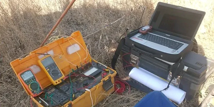
Our services
Our Reno field team runs resistivity surveys as standalone investigations or integrated with drilling programs. Every project gets a site-specific acquisition plan based on target depth and local noise conditions.
VES Sounding Campaign
Vertical electrical soundings at specified grid points across your site. We use a Schlumberger array with expanding electrode spacing to resolve layer resistivities and thicknesses. Ideal for groundwater exploration, bedrock mapping, and pre-drilling reconnaissance in Reno's alluvial basins.
2D Resistivity Imaging
Multi-electrode dipole-dipole or Wenner profiles along survey lines up to 800 ft. Produces continuous cross-sections that reveal lateral changes in lithology, fault zones, and perched water. Frequently combined with CPT or SPT borings to calibrate geophysical signatures against physical samples.
Common questions
What does a VES survey typically cost for a Reno site?
Most residential and light commercial VES surveys around Reno run between US$630 and US$1,020 depending on the number of soundings, maximum depth of investigation, and site access conditions. Steep terrain or sites requiring long cable runs across asphalt can push toward the upper end. We provide a fixed-price proposal after reviewing the site location and your target depth.
How deep can electrical resistivity surveys see in Reno's geology?
With the Schlumberger array and spreads up to 500 ft for AB/2, we routinely resolve layers to 200-400 ft depth across the Truckee Meadows. The practical limit depends on site noise — proximity to power lines, buried utilities, and rail corridors along the Union Pacific line can reduce effective depth. In quiet areas of North Valleys, we have reached clean signal past 350 ft.
Can resistivity distinguish between dry gravel and saturated sand?
Yes — and that is one of the primary reasons we run VES in Reno. Dry gravels in the eastern foothills show resistivities above 200 ohm-m, while saturated sands and silts in the basin typically drop below 30 ohm-m. The contrast is sharp and reliable, which makes resistivity an excellent tool for mapping the water table and perched zones before excavation or dewatering design.
Do you need to drill holes for a resistivity survey?
No drilling is required. We push stainless steel electrodes into the top few inches of soil along the survey line. The method is non-invasive and leaves no surface disturbance — a major advantage on paved lots, landscaped properties, or sites where underground utilities restrict mechanical drilling. Setup takes about an hour for a typical four-electrode VES spread.